

Feature and level surveys are crucial components of construction and development projects in Elwood. Whether you’re planning a new building, renovating an existing structure, or designing a sports field, these surveys provide essential data that can significantly impact the success of your project. This article delves into the importance, methods, and applications of feature and level surveys, helping you understand their role in various types of projects.
The Importance of Feature & Level Surveys
Feature and level surveys, also known as topographic surveys, provide detailed information about the land’s surface and its features. These surveys are essential for:
- Accurate Planning: They offer precise measurements of the land’s topography, enabling accurate planning and design.
- Risk Mitigation: Identifying potential issues such as flood-prone areas or unstable soil conditions helps mitigate risks.
- Cost Estimation: Detailed surveys help in estimating costs accurately, preventing budget overruns.
- Regulatory Compliance: Ensuring compliance with local regulations and building codes is easier with precise data.
Methods of Conducting Feature & Level Surveys
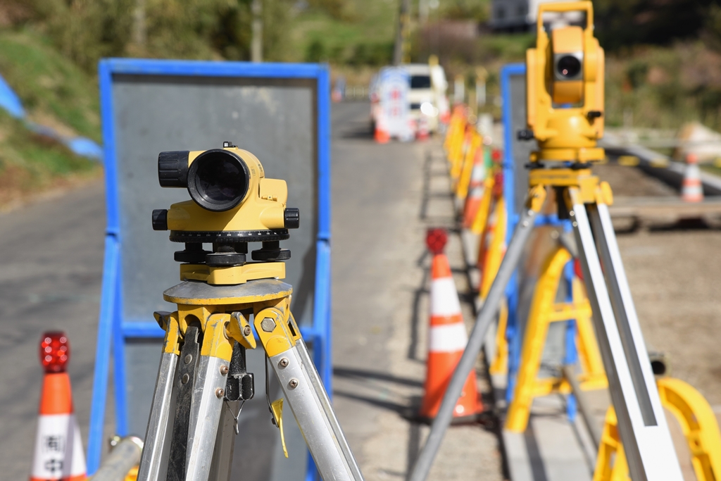
Traditional Surveying Techniques
Traditional surveying methods involve manual measurements using instruments like theodolites and total stations. Surveyors use these tools to measure angles and distances, creating a detailed map of the surveyed area. While reliable, these methods can be time-consuming and labour-intensive.
Laser Scanning
Laser scanning, or LiDAR (Light Detection and Ranging), is a modern technique that uses laser beams to create high-resolution 3D models of the surveyed area. This method is highly accurate and efficient, capturing vast amounts of data quickly. It is particularly useful for complex sites with numerous features.
GPS Surveying
GPS surveying utilises satellite signals to determine precise locations on the Earth’s surface. This method is fast and efficient, making it ideal for large areas. However, its accuracy can be affected by obstacles like buildings and trees that block satellite signals.
Aerial Surveys
Aerial surveys use drones or aircraft equipped with cameras and sensors to capture detailed images and data from above. This method is excellent for surveying large and inaccessible areas quickly. It provides a comprehensive view of the terrain and its features.
Applications of Feature & Level Surveys
Construction Surveys
In construction projects, feature and level surveys are essential for site planning, design, and construction. They provide detailed information about the site’s topography, existing structures, and utilities. This data is crucial for:
- Site Layout: Planning the layout of buildings, roads, and utilities.
- Earthworks: Estimating the volume of earth to be moved and determining the best locations for excavation and fill.
- Design Accuracy: Ensuring the design conforms to the site’s topography, preventing issues during construction.
Internal Measurement
Internal measurement surveys are used to map the interior of existing structures. These surveys are vital for renovation and refurbishment projects, providing detailed data on the building’s internal layout, dimensions, and features. They help architects and engineers create accurate plans and avoid costly mistakes.
Laser Scanning for Detailed Surveys
Laser scanning is ideal for detailed surveys, capturing intricate details with high precision. This method is used in various applications, including:
- Heritage Conservation: Documenting historical buildings and sites with high accuracy.
- Infrastructure Maintenance: Assessing the condition of infrastructure like bridges and tunnels.
- Urban Planning: Creating detailed models of urban areas for planning and development.
Sports Field Surveys
Sports field surveys are essential for the design, construction, and maintenance of sports facilities. These surveys provide precise data on the field’s dimensions, surface conditions, and features. They help ensure the field meets the required standards and provides a safe and enjoyable environment for athletes.
Choosing the Right Survey Method
Selecting the appropriate survey method depends on various factors, including the project’s size, complexity, and specific requirements. For instance:
- Large Projects: GPS surveying or aerial surveys may be more efficient for large-scale projects.
- Detailed Analysis: Laser scanning is ideal for projects requiring high precision and detailed analysis.
- Site Accessibility: Aerial surveys are suitable for areas that are difficult to access on foot.
Working with Professional Surveyors
Hiring experienced and qualified surveyors is crucial for obtaining accurate and reliable data. Professional surveyors use advanced equipment and techniques to ensure the highest level of accuracy. They also understand local regulations and can help ensure your project complies with all legal requirements.
Conclusion
Feature and level surveys are indispensable tools in the construction and development process. They provide essential data that helps in planning, designing, and executing projects efficiently and accurately. Whether you’re working on a construction project, an internal measurement, or a sports field survey, understanding the importance and methods of feature and level surveys will help you achieve better outcomes.
By leveraging modern surveying techniques like laser scanning and GPS surveying, you can obtain precise and comprehensive data, ensuring your project is successful from start to finish. Always work with professional surveyors to ensure the best results and compliance with local regulations in Elwood.