
As we approach the halfway point of 2018, one cannot help but notice the amount of technology that we use every day and how it affects our daily lives. While George Jetson isn’t whizzing by in a flying car to his glass condo in the clouds, we are utilizing an incredible amount of technology in normal life, and one of them (which is becoming increasingly popular) is the famous GPS! We can’t deny it; we all use GPS in our daily routines, even if we don’t drive. In fact, if you’re reading this on your phone, you’re reading it on a GPS receiver.
GPS stands for Global Positioning System. The system uses signals transmitted by orbiting satellites to pinpoint a device’s location and determine any movement over time. On its own, GPS has limitations as it only provides basic information such as coordinates and a few other statistics. Still, when combined with other technology, such as maps, and incorporated into navigational systems, it becomes a powerful tool.
Initially developed by the US Department of Defense for military use, GPS is now widely commercially available to the public, often incorporated into products such as stand-alone or built-in navigation devices for road vehicles and boats, as well as apps for smartphones. Let’s check out some of the mind-blowing benefits of this striking tool!
Available Anywhere
One of the best features of GPS is that because it primarily works through satellite technology, it is available across the entire globe. There is no need to be caught out not knowing your own location, or get lost.
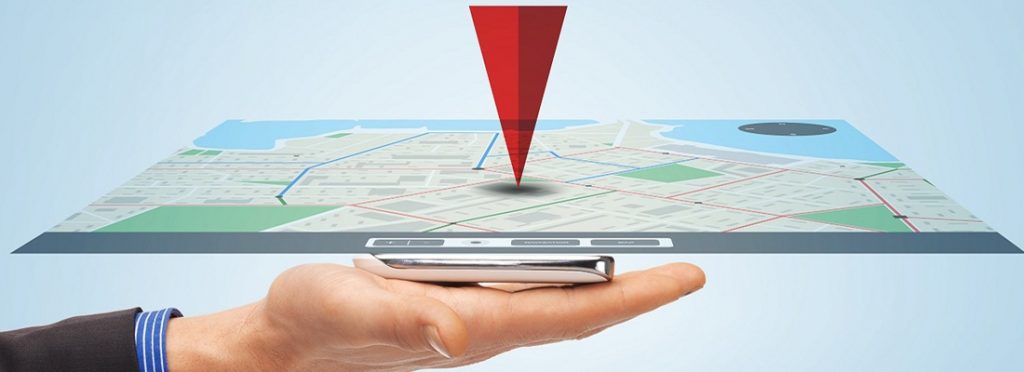
Navigation
Perhaps the most common use for GPS is in navigation systems. Combined with map technology, it becomes a powerful tool for road vehicles and boats. GPS can pinpoint a device’s location with accuracy, and by comparing coordinates, the statistics can be used to calculate the direction of a device of movement and speed. This information can be used to provide step-by-step directions from Point A to Point B in real-time.
Flexible Route Options
GPS gives you route choices in live time, enabling flexibility. You can choose a route according to your particular needs or desires. If you take a wrong turn, a new route can be calculated using GPS. If your direction becomes blocked by an incident, GPS can be used to calculate a new pathway.
Low Cost

The satellites behind GPS are paid for, maintained and upgraded by the US Department of Defense. That means that the system is mostly free, although you may have to pay for a device and software to utilize it. Smartphone apps, such as Google Maps that use GPS, are also usually free.
Easy to Use
Navigation using GPS is generally straightforward and requires minimal skill or effort, certainly when compared to traditional methods and technologies, such as map-reading. In most cases, the user just has to input the destination, and the device will do the rest. GPS is also an easier and more efficient technology to use for tasks like surveying and the study of the movement of tectonic plates.
Updated and Maintained
GPS is paid for, updated, and maintained by the US Department of Defense, so that it is always accurate. Most software, apps, and devices that use GPS are also regularly updated, generally for free. So unlike a traditional printed map which goes out of date after a while, GPS and related technology usually stay very accurate.
Employer Monitoring
Employers can use GPS tracking to make sure that their drivers are behaving responsibly, such as following the quickest route, and not wasting time or fuel by going off track, as well as following speed restrictions. Businesses can also provide better customer service if they know where delivery or service vehicles are at any one time. A fleet of cars can be used more efficiently using GPS.
Crime & Security
GPS can be used as a valuable tool by law enforcement to track criminals or terrorists, using devices they attach to vehicles, or through monitoring the perpetrator’s smartphone. GPS tracking devices can also be used to deter theft by employers or ordinary people.
Safety
GPS tracking can be used by parents to keep tabs on their children. Spouses can also use similar technology to keep track of their partners. Workers and others can also use GPS tracking for personal safety so that their whereabouts are known if there is an emergency.
Neighbourhood Search
As well as navigation, GPS can also be used to provide information on the local area. For instance, finding out where the nearest hotel or gas station is, or discovering nearby restaurants that are open for business. That’s convenient when you are on a long road trip and need to find a place to stop for food, gas, sleep, and so on.
Traffic & Weather Alerts
One of the great things about GPS is that it is all happening in real-time. That means that you can be notified if there is a traffic accident or other hold-up ahead, or if you are approaching an area where there is a severe weather event occurring. Not only can this shorten your journey time, but also improve safety.
Exercise Monitoring
GPS can be used for exercise monitoring and can help amateurs to improve their health and fitness, as well as professional sportsmen and women. It can be used to calculate speed, distance travelled, and even use the information to estimate calories burned.
Buildings and Earthquakes
There are many scientific applications of GPS beyond just navigational matters. It can be used to help detect structural problems in roads and buildings, as well as predict natural disasters like earthquakes through the monitoring of tectonic plate movement.
Surveying

Land surveying takes place before construction or development. Over time, GPS has gradually replaced traditional land surveying techniques, mainly because it is cheaper, quicker, and usually more accurate. It often takes hours with GPS, rather than days. If you’re looking for surveying experts in Melbourne, contact Flat Out Surveying! With over ten years of experience, they provide accurate and surveying solutions for construction and engineering projects ranging from UAV surveying, 3D laser survey to engineering survey and much more cost-effective solutions.